Find Dangles
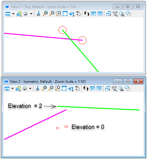
In the sample below, the coincident endpoint of the dangles share same X and Y coordinates but is offset in the Z direction. With Consider Z enabled, the flags are placed at the elevation of the dangling end points.

With Consider Z not enabled, the disconnect between lines is not found and the flags are placed at elevation zero.